In August a book by me on Ladakh (Ladakh- Changing, yet Unchanged) was published by Rupa & Co, New Delhi.
Many maps were to be included, but unfortunately these maps were in colour. To include them all would have increased the cost of the book immensely.
I am including the missing maps in my blog in the hope that some one who has read my book will chance upon this blog too!
This is an elevated graph like sketch of the fascinating Manali to Leh road. Most of the important places are shown.>
The route, almost the same length, to Leh from Srinagar>
Pense la in Zanskar and an idea of the view fromthe motor road-
Between Saspol and Nimoo is an attractive barren stretch called Bazgo Thang at 12,000'. After that is the village of Bazgo. The map below is of an attractive trek from Bazgo to Hundar in Nubra>
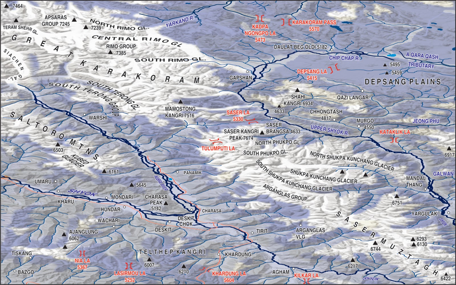
The Karakoram>
Saser La and N,S,E and W>
An aeriel conception from Siachen Glacier to Depsang Plains>
From Saser Group to Rimo Glaciers >
The less frequented (by tourists) region between Tankse (to the North) and the River Indus (to the South)>
I have jumped North to Siachen with this one>:
This map shows the likely sources of the Chip Chap river that becomes the Shyok in the West and a small stream that becomes the Qaraqash in the east and China:
The high point of a visit to Ladakh: Pangong tso also showing Srijap and Yula, which from October 1962 have been under Chinese occupation. COL means Chinese Occupied Ladakh> ;-
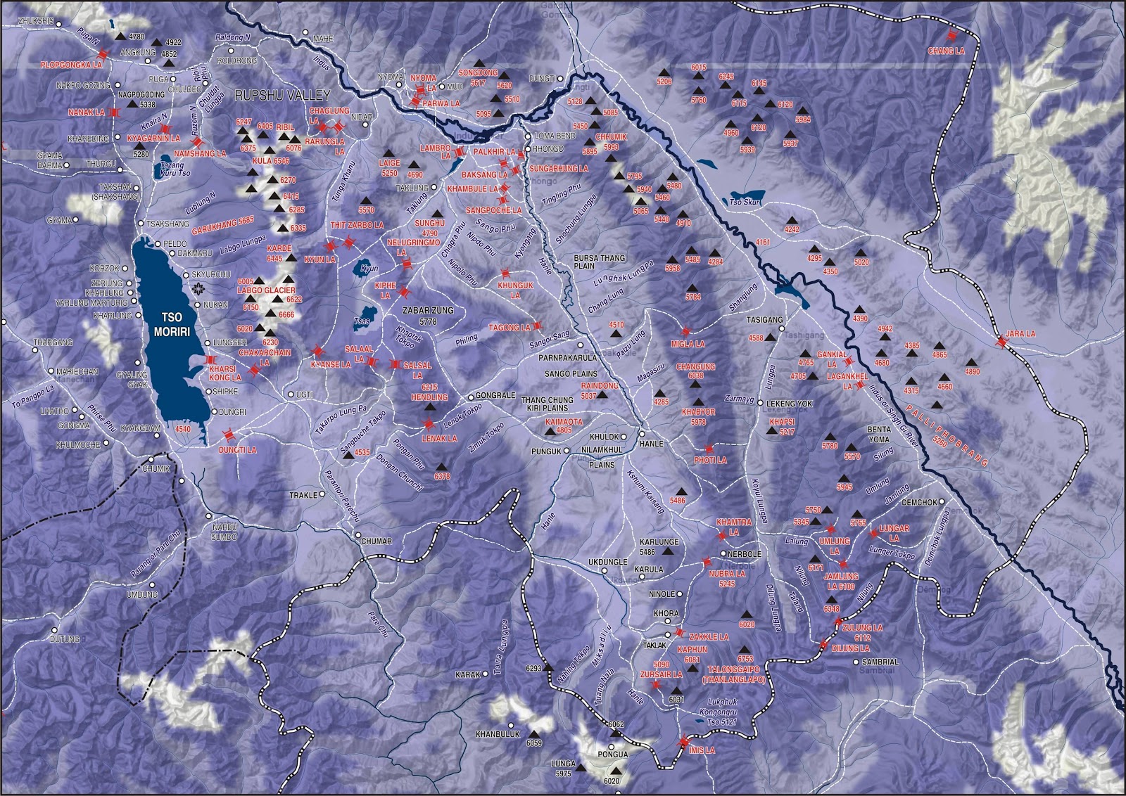
Tsomoriri:
This last map is of the Changchenmo river from its source till its confluence with the Shyok. From Kongka la to Lanak (Lenak too) La its all C O L>


1 comment:
I appreciate you sharing these detailed maps, they are very helpful for visualizing Ladakh.
Post a Comment