Tuesday, March 19, 2013

Ladakh- Changing, yet Unchanged-- missing maps


In August a book by me on Ladakh (Ladakh- Changing, yet Unchanged) was published by Rupa & Co, New Delhi.

Many maps were to be included, but unfortunately these maps were in colour. To include them all would have increased the cost of the book immensely.

I am including the missing maps in my blog in the hope that some one who has read my book will chance upon this blog too!


This is an elevated graph like sketch of the fascinating Manali to Leh road. Most of the important places are shown.>


The route, almost the same length, to Leh from Srinagar>


Pense la in Zanskar and an idea of the view fromthe motor road-


Between Saspol and Nimoo is an attractive barren stretch called Bazgo Thang at 12,000'. After that is the village of Bazgo. The map below is of an attractive trek from Bazgo to Hundar in Nubra>

The Karakoram>


Saser La and N,S,E and W>


An aeriel conception from Siachen Glacier to Depsang Plains>


From Saser Group to Rimo Glaciers >


                               The less frequented (by tourists) region between Tankse (to the North) and the River Indus (to the South)>

      
I have jumped North to Siachen with this one>:


This map shows the likely sources of the Chip Chap river that becomes the Shyok in the West and a small stream that becomes the Qaraqash in the east and China:


The high point of a visit to Ladakh: Pangong tso also showing Srijap and Yula, which from October 1962 have been under Chinese occupation. COL means Chinese Occupied Ladakh> ;-  


Tsomoriri:


This last map is of the Changchenmo river from its source till its confluence with the Shyok. From Kongka la to Lanak (Lenak too) La its all C O L>

Sunday, March 17, 2013

Alternative Development for opium producers: Forest Rights, Land Tenure & Community Participation

India once had many large forests. Urban demand for wood and minerals have demolished most of our forests. The Government till now was brazenly indifferent to the fact that forest dwellers were being dispossesed  The latter were never ever consulted. Today, less than 20% of it is forested. 12% of this area is in about 7% of the land that is known as India's North East. Yet, denudation continues as people are still to be given title deeds to the forest lands that have been their homes for centuries. Since 2007 India has a forest dweller friendly forest act but it has not yet been implemented forcefully. On many forest clearances in Arunachal and Manipur opium is being grown.


                                                           (Opium poppy flowers)
1. In early 2007 India enacted the Scheduled Tribes and Other Traditional Forest Dwellers (Recognition of Forest Rights) Act, 2006. { http://tribal.nic.in/ & http://tribal.nic.in/writereaddata/mainlinkfile/File1033.pdf}. An Amendment in 2012 {http://tribal.nic.in/writereaddata/mainlinkFile/File1434.pdf} prescribed a monitoring system.

'The tall branchless trees give an idea of the dense forest that once existed here in Saraipung, Upper Assam, India. They had no branches as they were packed closely together, and only when they reached sunlight would they have branches. Brazen felling of trees have opened the forests of the North East for more exploitation. The rights of the indigenous people who dwelt in places like these were ignored.' 

2. This new act is similar to FAO’s guidelines {http://www.fao.org/fileadmin/templates/cfs/Docs1112/VG/VG_Final_EN_May_2012.pdf}. The Ammendment of 2012 and Chapter 3 of FAO’s paper headed “Civil Society perspective on monitoring in the context of the Voluntary Guidelines” are identical.


3. The new Act recognizes the forest dwellers rights to live, hunt, fish and till within forests, permits access to forest resources and protects them from eviction. The most important feature is that forest dwellers’ lands can only be bequeathed and not sold, and have to be owned jointly by husband and wife. And no one can hold more than 4 hectares of land.
'At the base of a thick forest this plywood factory was started in the 80s in Khonsa, E. Arunachal Pradesh. An opium growing area. The Forest Rights Act of  2007 has given hope that such kinds of exploitation will end. '


4. It guarantees title deeds to land tilled by forest dwellers. The title deeds have to be recommended by the entire village with one third of those present being women. If land rights are given they can benefit from development schemes and be protected from exploitation. Assured of control over their land, and not having to shift fields will mean an economic boost. Some could leave opium cultivation.


5. Expectedly, two opium growing states in the North East- Arunachal and Manipur- have not implemented this Act. For, if they did so, no land would then be sold and all lands that have been fraudulently acquired could revert back to their original owners, which is repugnant for a powerful few. In Manipur opium gum is extracted, dried and stored as gum. In Arunachal it is extracted and then spread on jute or nettle cloth and sold in small pieces.


                                                       'Cloth opium'

6. Arunachal is an ethnic people’s state, and it is governed by elected representatives, most of whom were once forest dwellers themselves. A few people have hundreds of hectares each, and in one case (Manthi village in Kamphai Reserve Forest) a thousand hectares allegedly belong to one person! Had the new forest act been enforced this could never have happened.


7. I shall focus on Manipur and Arunachal. In the former Alternative Development has not worked and in the latter AD will not work! Chandel, Senapati, Imphal, Thoubal and Ukhrul in Manipur, and Yingkiong, Passighat, Changlang, Tirap, Lohit and Anjaw in Arunachal grow opium and under the present circumstances will continue to grow it.


8. In Manipur’s valley and mountains opium cultivation started about six years ago- only for profit. Now they are demanding legalisation. Only in Chakpikarong Sub Division, bordering Chin State of Burma, had opium cultivation on swidden land been traditional. The average size of the fields is about 20 X 30 mtrs. The yield is 20 kgs a hectare. In Manipur few consume opium, which is sold at about $500/- a kg. to adjacent Burma’s Sagaing and Chin states. It is grown in the irrigated valley and in the denuded hills. The hills have also harboured vast swathes of cannabis cultivation despite development. The cultivating areas have roads, electricity, phones, schools, colleges and hospitals. This is an insurgent hit state and the rebels are profiting from this activity too. Several recent large seizures of opium, and a seizure seven months ago of a mobile heroin laboratory with 7 kgs of opium, 1 kg of heroin and chemicals have shaken the Government.


9. Manipur’s hill areas are dominated by Tangkhul Nagas- a highly educated tribe that has been developed for generations. Many of its people are influential bureaucrats, politicians and highly paid professionals. Yet some support rebels. Their mountains have been devastated of trees because of collusion with timber lobbies. Many of the cleared areas have been used for cannabis, and some are under opium cultivation. However, if title deeds are given slash and burn lands will convert to terraced and irrigated fields and farming would become more profitable. Opium could then be history as the law provides for confiscation of opium fields. Commercial cultivation, such as this, can be discouraged only by enforcement.


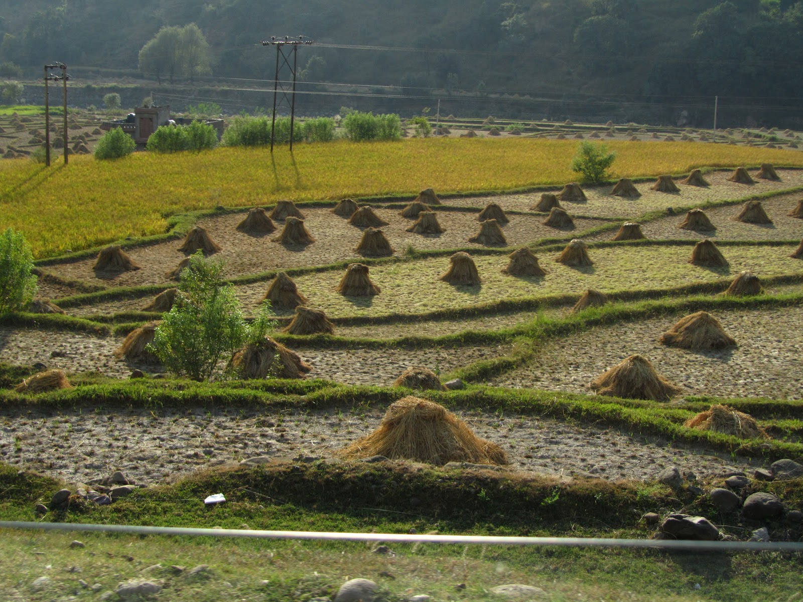
10. Arunachal has about 2.5% of India’s area but, despite indiscriminate logging, it still has 14% of its forests. In Lohit and Anjaw districts that border the hills of Burma’s Kachin State, opium has been grown for centuries on slash and burn land- known as jhum. The community decides which part of the forest is to be cleared and cultivated. Three decades ago the jhum cycle was about 30 years, but now it is 2 years. The reason is that forests are being cut rapidly by timber contractors and big businesses – from outside Arunachal- that require those giant trees for manufacturing plywood and furniture. This is done with the collusion of local leaders. In swidden fields felled trees were burnt for fertilizer and now that they cannot have.


11. Officialdom notices opium cultivation intermittently. From 1988 eradication started. There was no development in these two districts then. They were isolated and very poor. No health schemes, extreme destitution, only one road, no electricity, no jobs, shabby schools, no health care and no markets for their agricultural products. Individual opium plots were small, around 5 X 10 mtrs, and cultivated mostly by women. The yield hovered around a miserable 2 kgs per hectare. Opium cultivation and use was opposed by the youth in the 90s. A combined and sustained onslaught of eradication and urgent development followed. There are many roads, buses, many taxis, hydel dams, health centers, small businesses, jobs, phones, internet, banks, ATMs and contracts for locals. Even jewelers and traders from the plains have opened shops there. Life of almost half the population improved. A gigantic change for the Mishmi tribe, many of whom had led an impoverished existence a decade earlier. By 2000 opium cultivation had decreased by more than half and had retreated to clearings deep inside forests and over the ridges.

12. Then something happened. I cannot understand why. Maybe it were the reluctance to give scholarships, medical relief and agricultural grants and loans that were given smoothly, simply and quiuckly till the end of the 90s.

13. Perhaps it was political patronage by the elected representatives or maybe it was the demand from adjacent Kachin areas in NW Burma or both or more. From 2002 not only did opium cultivation balloon but the youth were addicted, including some women- something that was unheard of earlier. Opium fields are everywhere – in large fields by road sides, in kitchen gardens, and even within Tezu, the only town in these two districts. These fields replaced dark, dense and immense forests. The Mishmi’s steady customers were the Khamptis and Singphos living in lower Lohit district. The latter paid for their opium by cutting down forests. After the forests finished they started cultivating opium themselves, and all three tribes are now looking for more customers elsewhere. And women mainly manage the cultivation and sale of opium.


                                            'Selling cloth opium'


14. The average sized plots have increased to 10 X 20 mtrs and the yield is above 20 kgs per hectare. 11.7 gms (a tola) of cloth opium in season (March - April) is sold at farm gate for between $5-6. A kilo (83.7 tolas) for about $ 420/-. After keeping opium for their own use an average family makes about $1000-1500/- annually by selling opium. And tree cutting goes on to make way for more opium cultivation.


15. There are two kinds of cultivators. Rich and poor. The rich occupy land or slash vast dense public forests to cultivate opium. They also get to own orange orchards, cardamom plantations and tea estates. The poor own small fields, which produce opium for their own needs and a little for barter and sale. They also cultivate on lands that once had forests. Under the new Forest Act only 4 hectares of land at most can belong to one family. A few have a thousand hectares or so. That is why Arunachal is not implementing the Forest Act of 2007.

'A large opium field in a jhummed or swiddened clearing in Raliang village, Hayuliyang Circle, Ajnaw Distirct, Arunachal.'

16. The rich threaten violent action if there is eradication and the poor fall in line as their willing soldiers because of their abnormally high consumption of opium. This violence has kept selective enforcement at bay! However, if they are given title deeds to their lands it will eventually end swiddens and increase their income, provided they can chuck smoking opium. However I must add that those living far from the roads are still poor. For them opium is still the only medicine available, and they also barter it for essentials like grain, cloth and kerosene oil. Wide spread development has profited only a few.

'A poor man's low yielding opium field in Kondong village, Anjaw District.. The opium he uses to exchange for kerosene oil or better quality rice'


Anjaw Distirct: A poor opium cultivating man's wind swept hut in Kondong village. This is how some live- in 2012.  


'A rich opium farmer's house in Raliang village, Anjaw. Note the solar panel to the right.'  Raliang, Anjaw Distt.

17. Eradication cannot make them leave opium, and most do not wish to do so till they are consulted about opium use and cultivation. The only time that their voices are heard is after every five years during elections. Then they are plied with alcohol and opium and assured that their traditions will not be touched- meaning that opium cultivation will continue. Opium as a commercial crop is crucial to the leaders’affluence and influence. It is because of this that they encourage the tradition of slash and burn for it allows them to buy more cleared land. That is also why not one title deed has been given, while in Tripura, a North Eastern State, out of 182,617 claims received 120,473 deeds have been distributed till September, 2012, and the few small pockets of opium cultivation have gone.


18. High opium usage is the reason why development and restitution of land rights alone will not succeed here. As long as people continue to use opium it will always be cultivated. Many treatment centres have to be set up. At the moment there is only a squalid one at Lathao. Tezu hospital has had one for years, but it is not yet open. If the Government were to supply the users with opium, as was done from 1972 in other parts of India, they would stop growing opium for themselves.


19. It is also urgent and necessary now to discuss the problem with the people. In 2000 a sample survey of Lohit and Anjaw was done by the Central Bureau of Narcotics, where I was working. The UNDOC also participated. Of the 82 villages surveyed 55 grew opium but their yield was rarely above 200 gms per field. Now it is 3 kgs. Opium use amongst the young has increased by more than 50%. In early 2010 some of us based in Delhi and helped by 27 youth from the Mishmi, Singpho and Khampti tribes had, at the request of Arunachal Government, surveyed opium cultivation and its use in here (Report at http://www.narcoinsa.com/pdf/arunachal-opium-survey-report.pdf). Consulting the people was stressed by us in that report and at a meeting with the Government 10 months ago. The Government is still silent. The Central Government can only think of enforcement, which will not work. The State Government does not want to think. There are no NGOs working in this field. The future is bleak.

20. Development-led approach in India has not worked. Maybe it has not worked anywhere in the world either. Unless the long term opium users, who are myriad, are given their requirement of opium under medical supervision all such crazy castles built on the quick sand of Alternative Development will sink.


21. I shall end with some figures from the 2010 Report on Opium Cultivation prepred by the Institute for Narcotics Studies and Analysis, New Delhi (http://narcoinsa.con). These indicate a proliferating problem that no amount of development  will be able to control:


Some stats from ANJAW &  LOHIT districts:

Population 22,000 (approx.) & 142,000 (approx.) respectively-

Area 6190 sq. kms. & 11402 sq. kms.-

Families cultivating opium 90%  & 63% respectively-

Opium main income source for 186 out of 226 villages & 95 out of 232 villages respectively-

Land under opium cultivation 3460 hectares & 12981 hectares-

 87.8% of all surveyed in opium cultivating

villages of ANJAW & 96% of all in opium cultivating villages in LOHIT say cultivating opium is more profitable than any other crops-

Number of men users 1703 & 7825 respectively-

Number of women users 210 & 1075 respectively-


Map of Arunachal Pradesh showing the six opium growing districts>


Paper read at a TNI Dialogue, Bangkok, 17th December, 2012


Wednesday, March 13, 2013

Splendour, history and a battered environment on the Mughal Road


For centuries a thin traders’ track linked Kashmir with Delhi through Rajouri and Lahore. Then about 400 years ago Jehangir, the Mughal Emperor (1569 to 1627) artist, builder and conqueror widened the pencil line so that his elephants, camels, horses, dogs, pet leopards, palanquins and about 30,000 retainers could move safely on his frequent summer visits to Kashmir. Aurangzeb the last of the Great Moghuls got to Kashmir only once in 1665. It was during this visit that 15 elephants and four ladies perished in an accident below the Pir Panjal Pass possibly above today’s Poshiana village(Francois Bernier: Pg. 409, Travels in the Moghal Empire .Publ- 1670). That was the last of the grand caravans.

                                        ' Instruments of progress can be devastating for the environment, if levered for profit---'
                                         'Waiting to pounce on unsuspecting mountains'

The route continued being used by traders and Gujars – high altitude shepherds- on their twice a year migrations. From mid 19th C till the early 20th C several British explorers went this way but eventually the easier Rawalpindi- Uri route to Kashmir drew away all travelers leaving only the Gujars to walk this trail, which was gentle on the Kashmir side and tough from Rajouri.

'Leaving a usual Srinagar- crowded with a few quiet spots, take the road to Shopian about 60 kms away'


                                       'An early start will get you this kind of traffic only. Later it is a mess of honking and smoking infernal combustion engines.'


In the early 50s Sheikh Abdullah planned to connect Srinagar with Rajouri with a motorable road along the old Mughal Road. Lack of Central support and insurgency scuttled that dream for many decades. In 2005 construction started, but it was Omar Abdullah, the present Chief Minister, who pushed the doddering project towards completion. There were now only 84 kms of road to be built. The Centre gave Rs. 300 crores and the J & K PWD built the link, from Shopiyan in Kashmir to Bafliaz in Punch, in three years.


 About 25 kms between Pir Panjal Pass (Pir Ki Gali) and Dogrian village on the Rajouri side are metalled in patches, but hundreds of taxis and a few buses do the trip daily till winter snows stop traffic.

'But Shopiyan in Autumn is bustling with apple related energy and commerce round the clock'


The old Mughal Road had Serais (large inns) and forts every 20 kms or so. Some of them are by the road and others can be seen from the road. Jehangir and Nur Jehan had done the most to dot the entire length from Delhi to Srinagar with grand large Serais which reduced in size as the mountains started.

Before Shopiyan the Rambiara flows quietly in autumn
and after Shopiyan
there is peace- no noise. '


From Srinagar, which has many structures from the Mughal era, to Shopiyan, the road is narrow and crowded. Shopiyan is one of the Valley’s largest centers for apples. Trucks go straight from here to all the large cities in India. After Shopiyan the wide new Mughal Road makes driving a pleasure. The road passes from extensive views of the Rambiara river crowned by Sunset and Tata Kuti peaks of the Pir Panjal Range to extensive forests of tall deodars (firs) of the Herpora Wild Life Sanctuary.

                                             'Herpora village'

At Dubjan,


a delightful large meadow surrounded by a few remaining pines and firs (most have been axed), the road crosses the Rambiara as it darts out of the restricting mountains to sprawl in the valley. Here is an army post and a store for bridge things. Nearby and below the road is a tastefully made wooden perch to view the pines and firs crowded valley and the higher slopes of silver barked birches leading to a snow ridge of the Pir Panjal Range. About 2 kms away, in a delightful meadow on a large mound above the confluence of Rupri stream with Panyar Yanga Nar are the ruins of 17th C Sokh Serai well past any hope of preservation. The snow ridge conceals a bevy of lakes on its east and western sides. Nandan sar, Chandan sar, Bhag sar and Katori sar etc. These were very popular trek destinations till the eighties, but now even though there seems to be no human movement the army does not allow any ‘adventurism’ here, as they fear that insurgents are still lurking about.


&


'a tastefully made gazebo shows the  Mughal Sokh Serai down in the valley of the Rambiara and above it the ridge in which are about a dozen enticing lakes'

 'There lies Sokh Serai to the right. The Mughals picked spots that had the best views.'


About 5 kms after Dubjan- a popular picnic spot for Kashmiris- the tree line is cleared and the road makes a long and ugly gash in a long and lovely alp till the Pir Panjal Pass (Pir ki Gali as it is better known today and PKG in the accompanying map) 16 kms away. The bridge over Panyar Yanga Nar is still being made so a dusty diversion is taken. Around this point is a sign inviting to admire the Aliabad Serai about 250 mtrs below set in a vast meadow called Pir Marg aglow with yellow anemones in October and blue iris (mazar posh in Kasmiri), yellow potentila and white saxifrage in July.

This
                                          +

                                                      =


      'The road is so comfortable that migrating Gujars in autumn take the tarred road leaving their old traditonal paths lower down- ' With Mount Harmukh - at 16,870' is Kashmir Valley's highest peak- glistening at the back>


                                       '..which is a good thing for they are not misusing the Mughal Serais as they used to in the past'
< My friend MA Qureshi from Srinagar standing in fron to the imposing entrance arch.

The Aliabad Serai


To reach it one has to go steep downhill over a rock fall followed by a pleasant downhill walk over the enveloping meadow. The Serai is about 50 X 40 mtrs and its gate is an imposing 7 mtrs high. The dome above the gate has caved in but the roof on the rest of the spacious complex is still there. There is meaningless and ghastly graffiti all over. The stone door sill is glazed like shining glass by centuries of use. Inside there are rooms behind arched doorways to north, east and west. The royal apartments are in the north heralded by a 4 mtr high arched darwaza. Ever since the Mughals stopped coming here the most regular occupants have been the Gujars. The Gujars have removed stones to have direct access to some rooms from outside. Smell of their flocks is everywhere and the walls are black from numberless fires. Some stones and wooden beams have been removed, and the lattice windows in the royal apartments broken. The mortar from the stone walls is also coming out. In winter the Serai is so full of with snow that entry is impossible. A little above the Serai are some graves surrounded by wilting mazar posh, iris lilies that are planted in cemeteries in Kashmir. Earlier people from SW Kashmir would bring the dead to bury them here, as close as possible to the Ziarat on Pir Gali. Above the Serai is a Gujar doka- a flat thick mud roofed hut. This is the traditional style that houses in Rajouri and Punch were made before prosperity made them switch to concrete. The vast green Pir Marg (meadow)in mid October was liberally sprinkled with yellow anemoines and potentillas. In July and August the carpet of flowers is much thicker and varied.


& more of its decapitated magnificence-


'A Gujar Dhoka that has been built with stones removed from Aliabad Serai...'


The Jammu & Kashmir Government has not done anything to protect and preserve this pearl from history. It’s a tribute to the engineering skills of the Mughals that this structure still stands despite consistent depredation through the ages. High above the serai and a little below the road is a sulphur spring, which attracts most of the Kashmiris driving by, as it has medical properties. Few tourists go on this road as there are no facilities at Rajouri or along the way.

The road to the Pir Panjal Pass rises slowly hugging gentle contours of alps. There is not a single hairpin bend, making it easy for even the driver to revel in the pretty views. There are a few distressing signs of environmental damage, some of which could have been avoided.


The historic Pir Panjal or Pir Gali (3494 m), as it is called now, is a wide V shaped pass at the end of a long meadow, strewn with rock falls in places. Bereft of snow it is not an impressive pass, and with the motor road, police and army huts and tents, the ubiquitous check post without which the security forces do not feel secure, a helipad and wireless antennae, its glory is considerably dimmed.


There is a ziarat built atop a fakir’s grave here. During Jehangir’s time a fakir, Sant Baba Sheikh Karim, famous for asking his procession not to make too much noise, used to meditate here and after his death was buried here. This fakir used to offer visitors water from the sulphur spring outside Aliabad serai. Late 19th C accounts (like Guide to Kashmir by Maj. Arthur Neve, 1892) say that from the ziarat Rawalpindi and Lahore could be seen on some clear days, but one cannot see even half that far now because of a perpetual haze.


The drama comes when the pass is crossed. The view is dramatic and disgusting.


    Elephants on the Mughal Road: The Mughal emperors used elephants to visit the Valley. On a steep section like this one elephant, in Jehangir's mammoth caravan, slipped and brought down several others. Many humans and elephants were killed.


'These numerous images are meant to shock and awe at what unnecessary havoc human greed can cause. A certain amount is essential to build the road, but so much? No.'

About a hundred meters above and below the road, and sometimes even further, the destruction of nature is fiercer, vaster and more horrible and thorough than any seen earlier. Steep mountain sides that were once covered with dark forests of birch, extraordinarily tall firs and lambent green alps have been largely stripped of their finery. The dominant colour is the grey of exposed rocks. No green of forests and meadows. The road plummets down a number of hairpin bends and past bare mountain sides that have been gouged, dynamited and scarred more than was necessary and then straightens out at a long spur before Chattapani bridge, also called Ratta Chamb. Had this been a Border Roads project the devastation would not have been that wide spread. The J & K PWD has completed what must be the most difficult road building project undertaken by a State Government, but it has also destroyed thousands of elegant trees and many square kilometers of meadows. I am surprised that the Ministry of Environment has not taken the State Government to task. Kashmir’s timber lobby is rich, powerful and regularly abuses the environment for profit. Earlier, centuries old Poplar trees that gracefully lined the Gulmarg road had been brazenly cut, and there was no protest.

Majestic deodars standing ram road straight about 30 to 40 mtrs high had delighted trekkers till the early 80s. These dense forests of Poshiana, Dargiana, Chattapani and Chandimarh had fascinated Mughal and Kashmiri poets, British explorers and hunters and Indian trekkers. Thousands of these trees have been slaughtered. The ground has literally been pulled away from under their roots. Some dead trees teeter drunkenly or are splayed helplessly by road sides or on hill sides, their grandeur stripped, waiting to be carted away to saw mills. In a few places can be seen old meadows, defying gravity, that are about to disappear as the ground beneath them has been cut away. The damage has been done and only reforestation can restore some of their lost eminence. In about 30 years new firs will be one third their full height. But that will not be in our life time.

After Chattapani stream, which is in the middle of a long U bend, the road slices a long impressive waterfall before Chandimarh that in better times used to roar through a thick and dark forest and emerge on to a high rock bursting into gossamer thin sprays and fountains. This sight had inspired an enchanted Nur Jehan to build a pavilion opposite it to admire it at leisure. There seems to be no sign of this structure as the old trekking paths had by passed it and the road has gone above it. Maybe it could be found and restored. Maybe even the forest too could be refreshed.


'Noor-e-Chamb- a pavillion that Nur jehan had had built for her bath is somewhere here but the road builders could not say where. Hope it exists.'


In October many Gujar caravans block the road on their way down, just as in May they do so while on their way up to the higher pastures. The Gujars families with their thousands of goats and sheep and attendant horses and dogs have benefited the most from this road, on which they have the right of way and cause frequent jams.


                                          'Thana Mandi: They have the right of way'

From Dogrian the road is comfortably tarred. Near Behramgalla the Chattapani meets with Parnai river to form the Surna, which is crossed at Bafliaz. The new road joins a 40 year old one here. Bafliaz (1300 m) is a large prosperous and busy village with roads to Punch and Rajouri bifurcating from here. The higher one goes to Rajouri through a closely planted young forest of firs, few elms and oaks. The earlier forest had been destroyed at the time of building the road about 40 years ago. This forest is already so thick that there are very few gaps to see the Pir Panjal Range and especially the Tata Kutti (4752 m) and Sunset peaks (4745 m).


Change is also seen in electricity pylons, mobile towers, dish TVs, many way side shops, schools, veterinary hospitals and dispensaries. There are a few surviving traditional flat thick mud roofed houses clinging to steep hill sides. The rest are concrete and tin roofed. From Bafliaz a thickly forest shaded section starts. Its a new (about 25 years old) forest. Seeing this man made forest I think that there could be hope for the denudation left behind. But in those years need for quick bucks was a bit less.


At the edge of the 22 kms long forest road that goes over a pass called Dera Ki Gali (2710 m) denuded hill sides start at the village of Azmatabad (Manial). Then comes the pretty urbanized cluster of Thana Mandi above the crystal clear Mangora or Thana nadi. In the heart of this entirely concrete town is an old Mughal serai, and fortunately for its future the Army has occupied it, thereby protecting it.

Thana Mandi's Mughal Serai- saved by Army's occupation>

Kashmir Government is indifferent to its priceless heritage as well as to its glorious environment. A ruin of a Mughal wall is all that remains of the Serai at Saaj>

In mid September the ripe yellow paddy fields and rain washed sweeping green hill sides and in early October the geometrically arranged hay stacks of cut paddy are a delight to look at.


An open air school bathed in warm sunlight belwo Dera ki Gali>


'A rare sight outside the Kashmir Valley: A large Chinar near Saaj at a height of about 900 mtrs asl' 

All along the way were Mughal serais but they have gone, their stones taken away. In Saaj only a small part of an arch is left. Thus is history ignored and reviled by the J & K Government’s Department of Archaeology.


As one comes near the low hills encircled Rajouri- a border town- the road is broken and rough and its sides have garbage stretching deep into the alleys that lead to it, an ugly contrast to its leafy and hilly surroundings. The Thana nadi meets the Dharwali Tao river at the entrance to Rajouri and their clean waters are sullied by plastic bags and filth. Congested, insanitary and neglected Rajouri (1022 m) is best observed from atop the Dhandhari fort made by Maharaja Gulab Singh in 1846 to keep his Dogra troops and store the grain that was forcibly collected as revenue from the peasants here. Its sole green lung that was a vast park in the heart of the town is now behind walls converted into an army air strip. The neat and extensive cantonment shows that cleanliness is easy, but the civilian authorities will not learn.

  
'Dirty filthy Rajouri does not look too bad from atop the Dogra Fort Hill.'


                                             'The last ridge is with Pakistan'


       'As this fort is an Army OP no pictures allowed inside. But the same view can be had from outside where there are no restrictions.'


'Inside the fort is a problem. Rabbits. Some kind soul sheltered a couple and now their numbers increase daily'
Now that Rajouri and South Kashmir are only 5 hours apart, apples and love cross the Pir Panjal pass to bring cheer to both sides. B grade apples that were earlier sold in Rajouri and Punch for Rs 100 a kg can now be bought for Rs. 30 or so. Same is with walnut and almonds. And some of the Kashmiri men who bring these fruits to Rajouri are also marrying girls from the latter region.


There is one more tryst to be kept. 24 kms from here above the right bank of the Nowshera Tawi is Chingus on the road to Jammu. Chingus means intestines in Persian. It was here that Jehangir had died on the 8th of November, 1927. Nur Jehan fearing a bloody war of succession had his entrails removed and buried here. She then had him stitched up and put on an elephant to make it look as if he was alive and left for Lahore, where Jehangir is buried in a mausoleum at Shahdara. His third son Shahjehan succeeded him. His grave is next to a mosque inside a walled serai that came up subsequently. Typically, there is no sign to guide a visitor to this historic site, which is by a busy state highway and often ignored. Only if one is looking for it can it be reached.

'Chingus Serai is not like other Mughal Serais which are neatly geometrical. A large quadrangle, divided into four squares, with rooms all around it, and two gates one pointing to Delhi and the other one to either Lahore or Kabul. This one is rather haphazardly built. '


'The mosque inside one of the squares of Chingus Serai. Behind is the Rajouri Tawi (river). It is on the excellent Jammu-Rajouri road'
'The tomb in which Jehangir's intestines are buried'


Kashmir is exceedingly beautiful, but if nature is to be mistreated its charm and magnificence will be whittled away till several generations later hazy memories will be thought to be mythical. Roads are essential but not greed.